Anyone attending the Society’s Northern Spring Meetings from south of Hebden will probably have travelled on the B6265. It starts outside the church at the top of the High Street in Skipton and heads northwards, through Grassington, to Hebden. But how many travelling this way have noticed what it does next? Read on to discover its peculiar 45-mile semi-circular route through some lovely countryside and interesting towns and cities to end up nowhere in particular.
It started life (in its modern incarnation) as the Skipton and Pateley Bridge Turnpike. On the first milestone out of Skipton, however, a West Riding CC Brayshaw and Booth replacement of the 1890s, the road is described as the Skipton and Cracoe Road. There are three of these – numbers 4 and 5 have not been found – after which one would not expect any more if the County Council thought the road stopped at Cracoe – though why they did not erect more will remain a mystery.
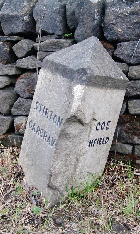
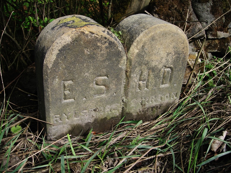 There are several boundary stones and guide-stoops on this first stretch. One stone, marking the boundary between Rylstone and Stirton with Thorlby, has the initials ESHD: the East Staincliffe Highway District erected a number of boundary stones in their area.
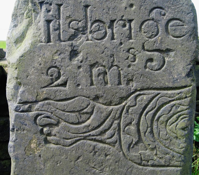
The guide-stoops, undated but probably from the early 18th century, are all in a similar style, usually with a pointing finger.
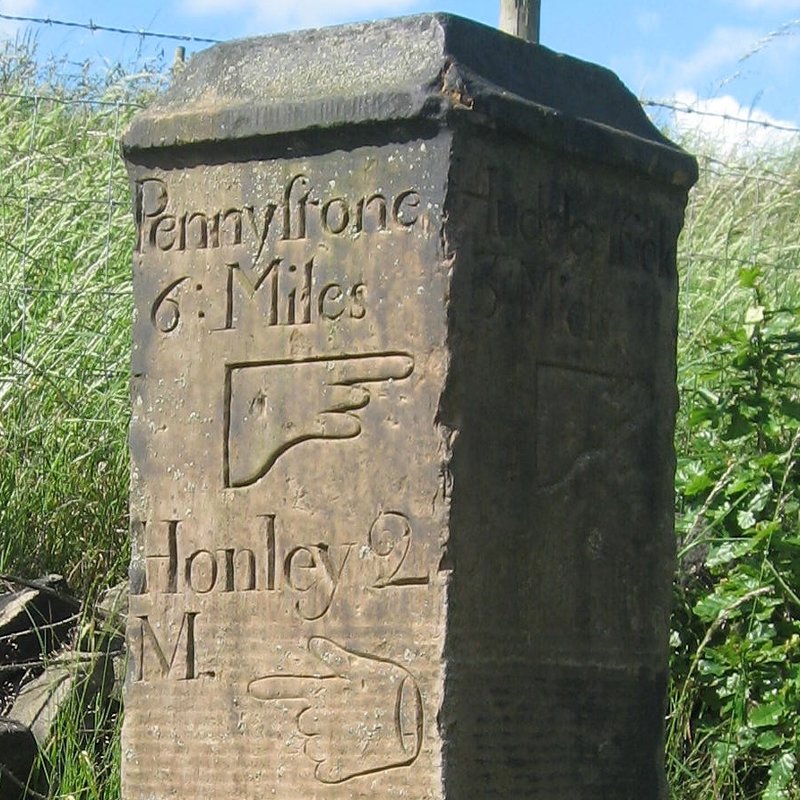
 About 2 km beyond Cracoe a branch of the road forks off to the right to Linton, where it loses its B-road designation but continues to rejoin the main line just before the bridge at Grassington – the main section having carried on to Threshfield and around to Grassington. There are three more guide-stoops in and around Linton.
There are also two earlier milestones, one marking seven miles from Skipton, just beyond the junction with the branch road to Linton, and one marking eight miles on the branch road in Linton itself. It is presumed that they are the original turnpike milestones, although it is not until the 1894 edition that they are shown on the Ordnance Survey maps, and there is one in an identical style further up the dale beyond Threshfield and not on the actual turnpike.
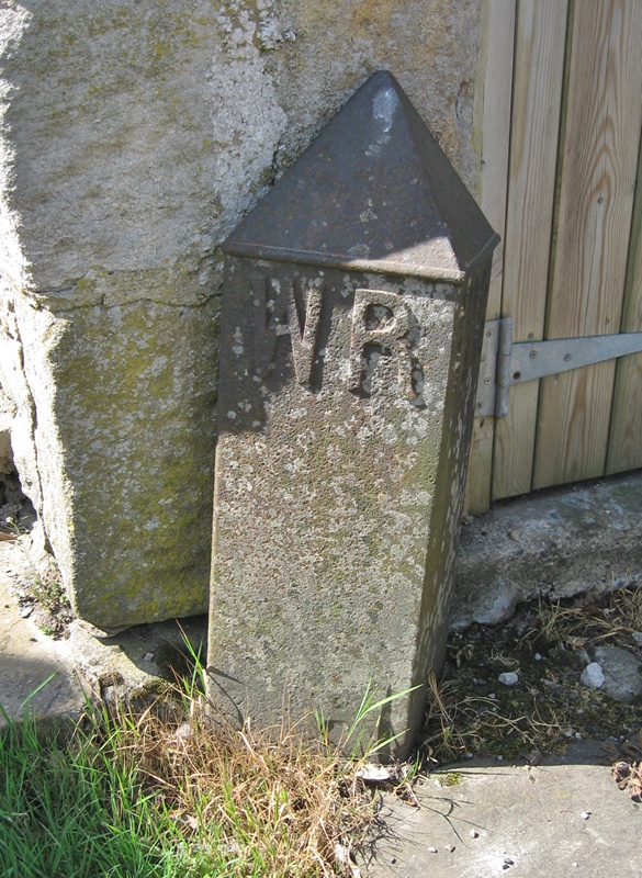
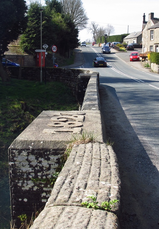
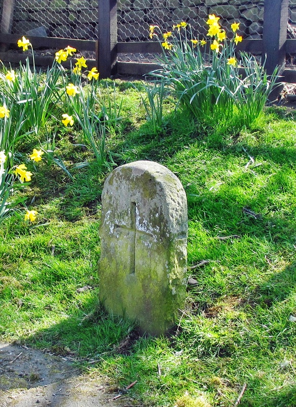
And so to Hebden. There are two bridges in Hebden, the old mediaeval one with a WR county bridge stone (pictured below, left), and the nineteenth-century one when the road was widened; this has a large 1827 carved on the parapet (pictured below, centre). Just off the road is a rather weathered guide-stoop, and just as you enter the village an interesting old stone on the right bears a simple cross (pictured below, right). This is actually a county bridge stone, denoting the point 300 feet from the bridge, where the parish responsibility for the road ended, and the county’s responsibility, for the bridge, began. There is a similar stone at Skirfare Bridge higher up Wharfedale.
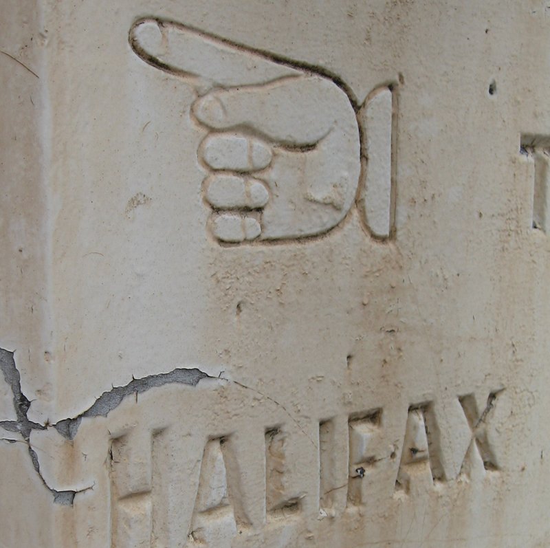
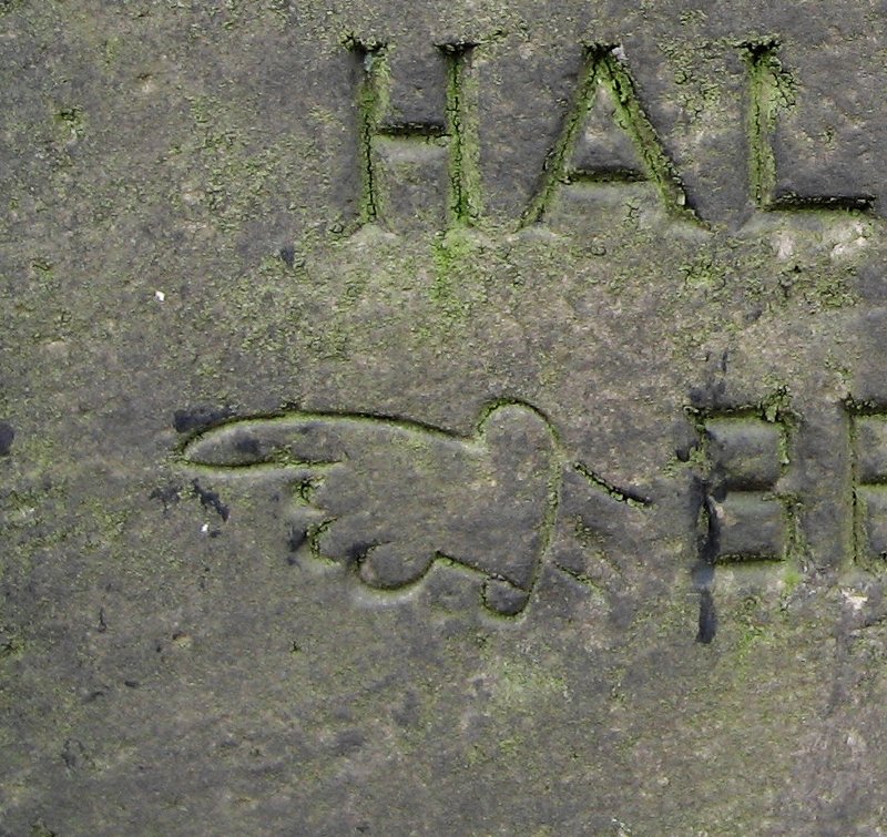
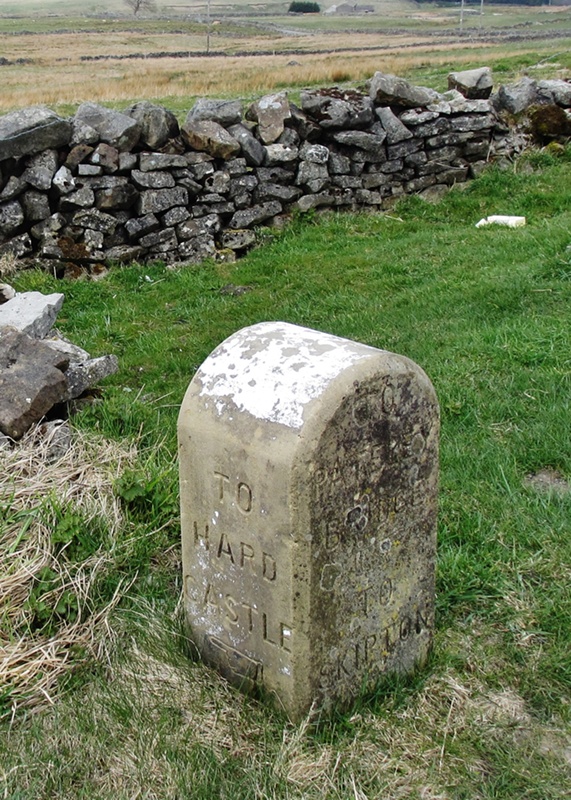 Beyond Hebden there are more guide-stoops, including, after Stump Cross Caverns, near Greenhow one in a different style with fingers pointing to Hardcastle, a now deserted but once bustling mining area (pictured left). And it’s also worth a look at Toft Gate Lime Kiln, just beyond.
The road now enters Pateley Bridge, where it turns right and for a mile joins the B6165. While that heads for Knaresborough our B6265 turns off and meanders north-east, passing the entrance to Studley Royal and Fountains Abbey, to Ripon. 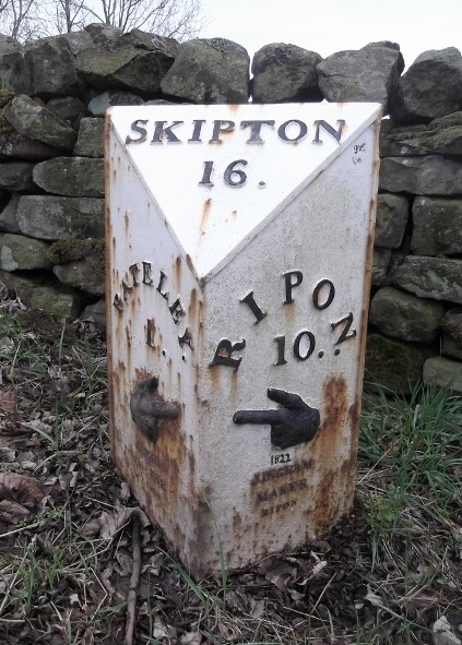 This, according to the 1854 Ordnance Survey map, is the province of the Ripon and Pateley Bridge Turnpike Trust. Along the road is a series of milestones, some in need of some TLC, with iron plates cast by Ingram, ironfounders of Ripon, many more of whose milestones can be found on other roads from Ripon. The last (or first from our direction) of these is in Pateley Bridge itself, on Ripon Road. The one illustrated here is the first one encountered on the B6265 as it turns off the B6165.
Finally, beyond Ripon, the road heads east (on part of the Harrogate and Hewick Turnpike) and then back south towards Boroughbridge: now on the line of the former A1, the Great North Road before it was widened, earlier the Boroughbridge and Piercebridge Turnpike, and long before that the Roman Dere Street.
The milestones on the stretch from Ripon are of the Ingram variety, but on the old Great North Road there is a different style with directions to Piercebridge. After Boroughbridge the Great North Road continues south to Wetherby while Dere Street, now the B6265, heads for York, part of the Boroughbridge and York Turnpike. A few milestones survive, but after about ten miles the road finally comes to an end at its junction with the A59 near Green Hammerton.
Curiously there is a bit more of the B6265. With the development of the A650/A629 Aire Valley Trunk Road, two old sections of the road have been re-designated as the B6265: one from Crosshills through Steeton into Keighley; the other from Keighley through Bingley to Cottingley. Perhaps some misty-eyed planner once thought of joining them all up.
RWH / rev July 2020
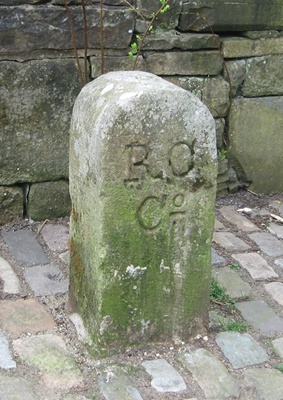

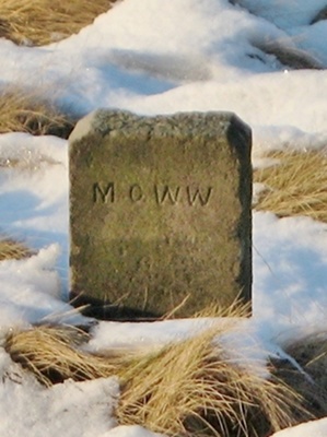 These works also needed boundary markers.
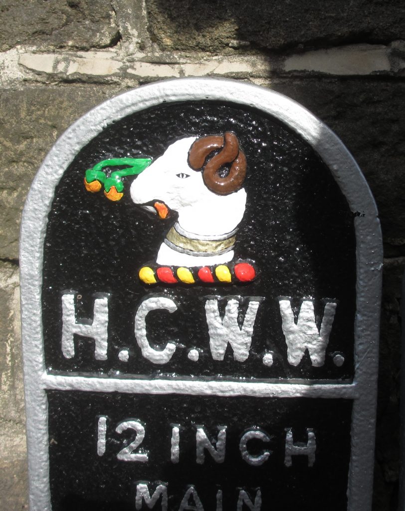 which the Holme Valley abounds), road name signs, and some plates from former water undertakings (Batley Corporation, Huddersfield Corporation and New Mill Urban District Council). The lamb that tops Huddersfield’s coat-of-arms looks especially attractive now – pictured right.
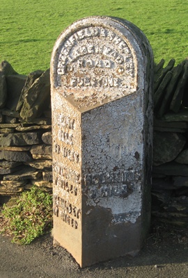


 A take-on stone is a stone instructing a coachman to add an extra horse or horses to a conveyance in order to help pull the coach up a steep hill. A take-off stone, conversely, is an instruction to unhitch the horse(s). Such stones are few.
 The concept of sanctuary, as a place where fugitives can be immune from arrest, dates back to the Bible (cf Numbers, 35), and was recognised in English law until abolished by James I in the 17th century. It was a way to protect people from the vagaries of mob justice. All churches could offer sanctuary within the actual church building, but there were over 20 churches in mediaeval England (including Beverley, Ripon and York in Yorkshire) which were able to provide a wider area of sanctuary.
 on an older line of the road, originally the Wibsey Bankfoot and Lidget Branch Turnpike, just north of the Stone Chair roundabout, sits the stone chair that gave its name to the area.
 possibly a resting-place for people (or, at least, one person) waiting for stage-coaches or other transport – and by the 1880s it had fallen apart, or even been destroyed.

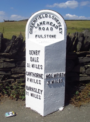
 mile or so beyond the Flouch the turnpike continued past Barnsley to Doncaster, while another branch of the old saltway headed right for Rotherham.
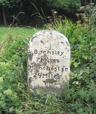 r roads.

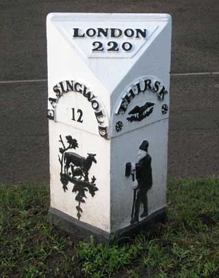
 On a number of roads in the vicinity of Thirsk in North Yorkshire are some series of milestones that are all very similar in design, although there is no indication on them of who made them.