
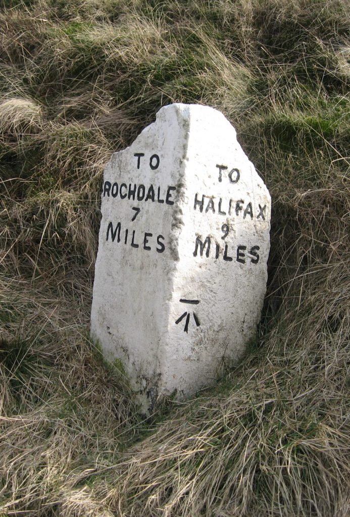
Some Yorkshire toll-houses


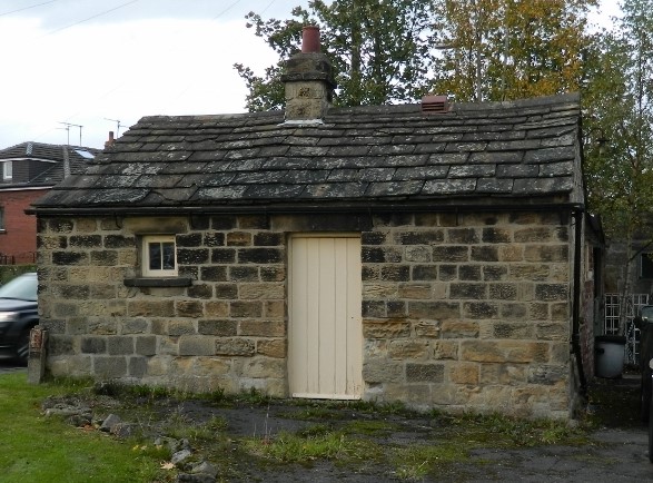

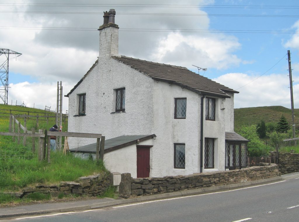
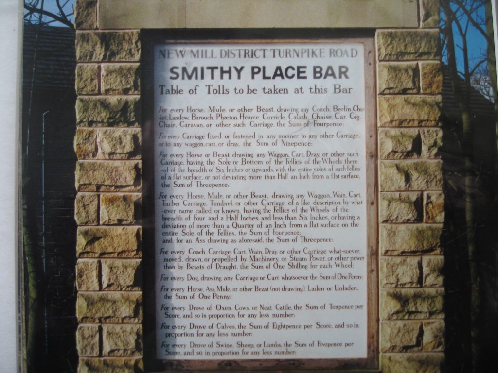

Some Yorkshire toll-houses Read More »
Some Yorkshire toll-houses Read More »

While the plates for most of milestones erected for the West Riding County Council in the 1890s were cast at Brayshaw & Booth’s foundry in Liversedge, a small number were made at William Towler’s Globe Foundry in Leeds. We have no evidence regarding why he was involved, but possibly he was brought in later in the project to ensure it was completed in time.
Towler’s plates can be found on at least four roads in the north of the county: the A629/A65 Keighley to Kendal Road (at Farnhill, south of Skipton, Long Preston and Thornton-in-Lonsdale); the A683 Sedbergh to Kirkby Stephen Road, at Cautley (illustrated); and the A684 Sedbergh to Hawes road. They are also on the B6255 Lancaster to Richmond Road (on the section through Ingleton as far as the old county boundary). Curiously this bit of road is not listed on the original contract for the milestones, so perhaps it was part of a second as yet untraced scheme. From the style it is probable that the other stones on these roads were also Towler’s: the name is not always discernable, but they are slightly different from the Brayshaw & Booths.

The original foundry was in existence in the early 19th century. The 1847 OS map shows a foundry off Water Lane on Globe Road in Holbeck, and Towler is first mentioned in Kelly’s West Riding Directory of 1881, where Dyson & Towler are listed as ironfounders on Globe Road. The firm also had a warehouse or showroom on Assembly St in the centre of Leeds. This building was originally the east side of the White Cloth Hall, opened in 1777, with assembly rooms on the top floor for the well-to-do in Georgian Leeds. It has been much altered and the other three sides demolished since, but it survives, is now listed, and is called Waterloo House.
The warehouse advertised chimney pieces, tiles, ovens, ranges, set-pots, mangers, stoves and all kinds of fire-places according to a photograph of around 1900-1910. [A set-pot is a stone boiler or ‘copper’, with a fire-grate under, for the purpose of boiling and ‘stewing’ dirty linen, according to Robinson’s Dialect of Leeds and neighbourhood]. They also produced coal-chute covers and grates for drains, which can still be found in the district. And, of course, milestones.
The company flourished for another half-century, but finally closed down in 1959.
Sources: various items turned up by search engines under ‘towler globe foundry leeds’; the photograph at the top, from the four miles to Sedbergh stone at Garsdale on the A684, is taken from a Milestone Society journal; illustration and listed building detail of Towler’s warehouse at http://www.leodis.net/display.aspx?resourceIdentifier=2003103_38804263&DISPLAY=FULL and https://historicengland.org.uk/listing/the-list/list-entry/1375290
RWH / rev July 2025
Towler milestones in the West Riding Read More »

The main road west out of Halifax, King Cross Street, splits in two at King Cross, just over a mile out of the centre. One road, now the A646, leads to Hebden Bridge and Todmorden, and into Lancashire. The other heads down to Sowerby Bridge and Ripponden, where it splits in two again: the A58 heads over Blackstone Edge to Littleborough and Rochdale, while the A672 heads over into Saddleworth (still in Yorkshire) towards Oldham.
All three roads have interesting histories and different milestones.
The Blackstone Edge road
This is a very ancient road, and was the first to be turnpiked, though the actual line has altered over the years. Parts are thought to be originally Roman: the Ordnance Survey describes three sections as Roman Road. Later it was a packhorse road: the paved section coming west off Blackstone Edge is thought to be mediaeval. It was turnpiked in the 18th century, the enabling Act of Parliament of 1735 connecting Rochdale with Halifax and Elland. Rather than continuing from Halifax to Elland there were two branches, one from each town, combining at Ripponden.
Milestones: for some unknown reason, the original milestones were not replaced by the West Riding County Council in the 1890s, and many survive. From Halifax the first is three miles along the road, just past Sowerby Bridge, though very little of it survives above ground level. Thereafter all but no 6 survive up to the county boundary, many well-cared-for.
The Elland branch also has a run of the same milestones, all four of which are still in position. There is also a stone at the junction in Ripponden acting as a guide-stone. This was refurbished, and the Golden Lion public house opposite renamed The Milestone, in 2011. Some had their destinations erased to foil any German invaders during World War Two, and some have been re-carved.
The road to Todmorden
The Act of Parliament – for “diverting, altering, widening, repairing and amending the Roads from the Town of Halifax, and from Sowerby Bridge, in the County of York, by Todmorden, to Burnley and Littleborough, in the County of Lancashire” – was passed in 1760, though the road was not completed until 1781.
The road to Burnley (still today’s A646) continued to follow the River Calder through the narrow valley bottom – replacing the earlier Long Causeway which ran over the moors between Burnley and Heptonstall. The other branch, to Littleborough where it joined the Blackstone Edge road, provided a longer route to Rochdale, but one less susceptible to bad winter weather. A westward branch off this road led to Bacup and Rawtenstall.
Milestones: from King Cross to Todmorden an almost complete run of very attractive milestones survives. Most are flat with a sort of roll-top, such as the one illustrated, which is at Luddenden Foot. They show the mileages to Todmorden and Halifax, with crudely-carved sleeved hands pointing the direction. The township name is also given, but not always visible now. Two of the milestones, near Todmorden, are of a different style, being two-sided.
While the milestones were thought to date from the late 18th century, Luddenden Foot was not created as a separate district until 1868. It would not normally, therefore, have been named on a milestone. This would mean that they date from the later 19th century – but before 1878 when the turnpike trust was wound up. Being still quite new when the County Council was established this may explain why they left as they were.
Identical milestones exist on the roads beyond Todmorden – as would be expected when they were all part of the same turnpike trust. On the road to Burnley there are eight: three in the West Riding and five in Lancashire (one is lost). There are just two on the road to Rochdale, with none in Lancashire. The Bacup road has three, but again all on the Yorkshire side.
The road to Saddleworth and Oldham

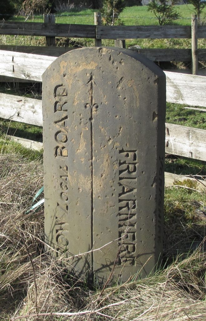
The last of the three roads (now the A672), this road was completed in 1798, following an Act of Parliament in 1795 creating the Oldham and Ripponden Trust. It left the existing turnpike at Ripponden, climbed up to the watershed and went down, briefly through Milnrow and (even more briefly) Crompton (both in Lancashire), back into Yorkshire (Friarmere, the northern part of Saddleworth),and into Oldham, to join what is now the A62 at Waterhead.
Milestones: curiously this is the only one of the three roads to have had its milestones replaced by the Brayshaw and Booth stones of the County Council. Most of these are still in situ, and there is one of the originals (though scarcely recognisable) just over the border on the Lancashire side, in Milnrow (then officially known as Butterworth). The Saddleworth mile-posts use the old division name of Friarmere.

A pre-turnpike guide-stoop still stands, just off the present route, but on an earlier line, possibly moved slightly to be a gate-post. Dated 1735, it has directions to Halifax (7 miles), Huddersfield (8 miles) and Rochdale (8 miles). The distances are the old customary miles, and the routes a traveller would have taken to reach both Huddersfield and Rochdale are barely indiscernible now: the Huddersfield route presumably led through through Scammonden, and the track to Rochdale could have taken various directions.
RWH / August 2020
Milestones on the roads west out of Halifax Read More »

This eleven mile piece of road (now the A61) was originally part of the Harrogate, Hewick, Ripon and Pateley Bridge United Turnpike which was an amalgamation of two Trusts in 1852. Hewick to Pateley Bridge is the current B6265 which also runs eastwards through Boroughbridge to join the A59 at Green Hammerton.
Harrogate had developed and grown throughout the 19th century because of its spa waters. What had been a small village was taking precedence over nearby Knaresborough with its castle. Killinghall was at the end of the Dudley Hill (Bradford) and Killinghall Turnpike, at its junction with the Harrogate to Ripon one.

Although the West Riding extended to the north of Ripon the mileposts on this route are different to those found virtually all over the old County Council area. They do not have the backing stone but are cast in a simple V shape. The inscription is rather elegant. The places names with serifs on the letters curve round the numbers and a prominent raised hand points the way on each side. On the top triangle is the distance to Leeds, with the mileages to Harrogate and Ripon and pointing hands on the two sides. Underneath these, on both sides, is the name of the iron-founder: J Ingram / Maker / Ripon / 1822. These details are not visible on all the mile-posts, but are clear on the one illustrated (picture by Christine Minto).
James Ingram is listed as a brass and iron founder in Baines’ 1822 directory, working in Kirkgate, Ripon. The foundry was actually down Peacock’s Passage. This was a very narrow covered ginnel between nos 13 and 15 Kirkgate (which leads from the Market Place to the Cathedral). Ingram was born in 1773, and descendants (presumably) of his are listed at the same address in trade directories later in the century: John George in 1866 (White’s), and William in 1881 (Kelly’s).
Maybe the mile-posts were still in good condition when the County Councils were formed 60-odd years later and the prudent West Riding Highways and Finance Committees didn’t want to spend more than was necessary and replace them.
There is a good run of these posts with only the 7 and 9 miles from Harrogate 9 missing, while the 3-mile post, near the bridge over the River Nidd, is a modern replica. When the Ripon bypass was built the 10-mile post was relocated near the traffic island. near the bridge over the River Nidd.
Source: a revised version of an article from the Milestone Society’s On the Ground, No. 5 September 2008, p 12.
RWH / August 2020
Mile-posts on the Harrogate to Ripon Road Read More »
The Act of Parliament permitting the construction of a 127-mile canal that would go all the way between Leeds and Liverpool was passed in 1770, and the first stretch of canal linking Skipton to Bingley was opened in 1773. The canal was gradually extended over the next 43 years until the final section, the Wigan flight, was opened on the 22 October 1816 and Leeds and Liverpool were finally linked.

The canal was originally marked with stone mileposts, though these only extended from Leeds to Johnson’s Hillock at Chorley, and from Aspull near Wigan Top Lock to Liverpool (the length in between actually being the Lancaster Canal). One or two of these survive, though with no surviving markings, in the Wigan area.
The existing cast iron mileposts date the 1890s. They were installed as a response to legislation introduced to regulate canal freight tolls – the Railway and Canal Rates, Tolls and Charges Order of 1893. This prompted the whole of the canal to be re-surveyed and new mileposts, along with half and quarter mileposts, installed along the towpaths.
200 years later the mileposts had become damaged and approximately a third of the original 127 were missing altogether. In 2003 the British Waterways Board (now the Canal and Rivers Trust) sponsored a programme to clean and paint the mileposts between Bingley and Gargrave, and cut back the vegetation. A survey then found that nearly 25% of the posts were missing and that only one milepost was complete.
And so to celebrate the bi-centenary of the completion of the canal the EveryMileCounts Project was established, aiming to restore all of the mileposts, replacing those that were missing, repairing those that were damaged, or simply cleaning and repainting those that were intact – and to do as much of this as possible with the help of the communities that live along the canal.
All the mile-markers are now in situ, about 20 of the 33 missing half-mile plates have been re-instated, though the 85 missing quarter-mile plates are still absent.
Adapted mainly from an item by Bill Froggatt, Heritage Adviser for the Canal and Rivers Trust, in the Milestone Society Newsletter, Feb 2016, no 30, p 27, and talks by him to the Northern Spring Meetings, 2016 and 2023.
RWH / rev May 2023
Mileposts on the Leeds and Liverpool Canal Read More »

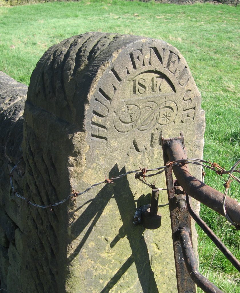
Decorated gate-posts with abstract patterns can be found all over Yorkshire, but Abraham Hirst of Elland took this one step further in the middle of the 19th century.
Hullen Edge is an area of Elland in West Yorkshire, deriving its name from holly bushes, which were presumably more common there once upon a time. Its Hall, originally built in the 15th century and belonging to a branch of the omnipotent Savile family, was rebuilt twice in the 19th century and none of the original remained. The park of the same name, part of the estate, was given to the people of Elland in 1887. The adjacent cricket ground was, in June 1878, the site of a three-day match between the first Australian touring side and an 18-man team from Elland. The Australians scored 90 and 85, their opponents 29 and 66, and won by 80 runs.
In the 1850s it (and its nearly 150 surrounding acres) was occupied by Abraham Hirst (1790-1864), a rich woollen merchant from Huddersfield. Unmarried, his next of kin was a spinster niece, and the property was sold on his death.
Abraham left his mark on the estate with the name Hullen Edge on several stones and gateposts to denote the boundary of his property. They bear different dates, 1847, 1854, 1859 and 1862, and some also have his initials, AH. They can be found on the roads (or tracks) to Rawroyds, Holywell Brook and Blackley.
Sources: Albert Rinder: A history of Elland (1987); www.ellandcc.co.uk/about-ellandcc.asp; www.calderdalecompanion.co.uk
RWH / August 2020
Hullen Edge boundary stones Read More »

An Act of Parliament was passed in 1758 for the building of a navigable waterway to connect Wakefield with Sowerby Bridge. This was ultimately to connect the North Sea with the Irish Sea: the Aire And Calder Navigation had reached Wakefield in 1702 – from Goole on the River Ouse. From Sowerby Bridge it was to connect via the Rochdale Canal to Manchester, though this was not completed until 1804. From Manchester the Irish Sea had been accessible via the Bridgewater Canal since 1761.
The Calder & Hebble reached Sowerby Bridge in 1770; it was part canal and part river, 22 miles long and with 28 locks at the time it was built. There was a short branch into Dewsbury and a longer one up to Halifax by the side of the Hebble Brook – hence the name. The Huddersfield Broad Canal was started in 1774, leaving the Calder & Hebble at Cooper Bridge.
Along its course the navigation has a number of interesting remains that are not always unique but certainly characteristic of the waterway:
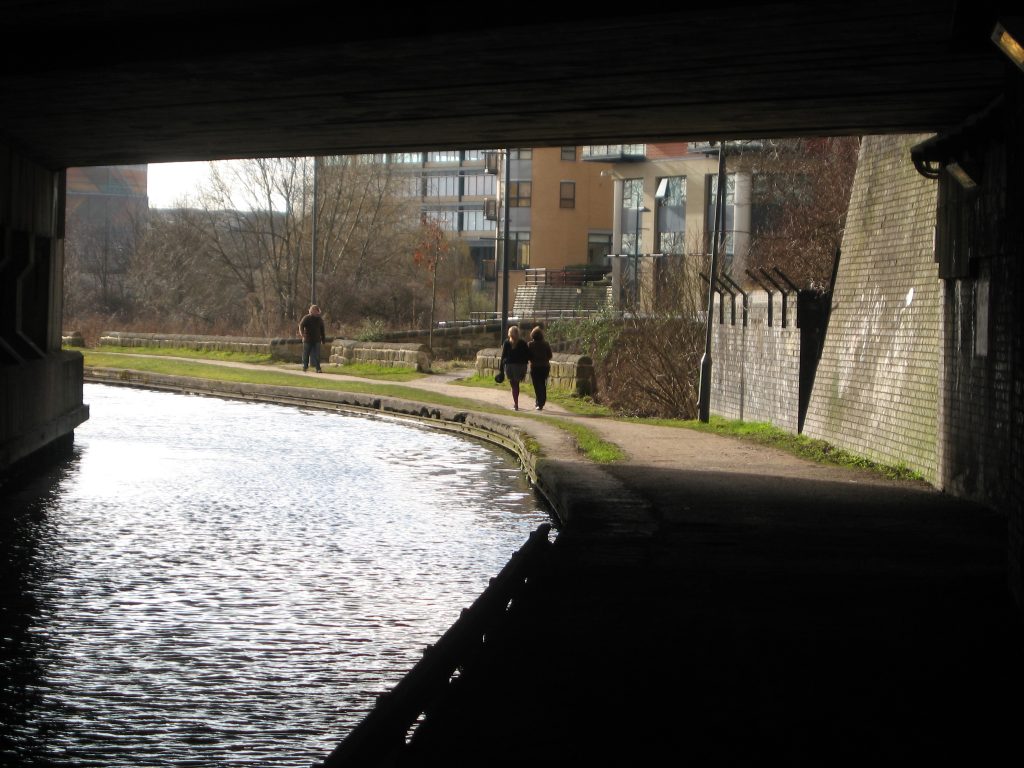
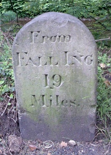
Milestones – The navigation started at Fall Ing Lock in Wakefield. (Fall Ing was a small suburb south-east of the city). Accordingly, all the milestones recorded the distance as “From Fall Ing … miles”. Approximately ten still exist, with particularly good examples at Salterhebble and Battyeford.
Half-mile and quarter-mile stones – Only a handful of these remain, including a half-mile stone found at Brookfoot and a quarter-mile stone at Thornhill Junction. The idea of half- and quarter-mile stones was imitated by the later Leeds-Liverpool Canal where many still survive although in a metal format painted white. They were probably to help with working out haulage charges.
Lock markers – Several of these can still be found; their purpose is simply to make boatmen aware of the proximity of locks. A 100 yards example can be found at Brookfoot near Brighouse whilst a 300 yards example can be found at Kirklees Lock.
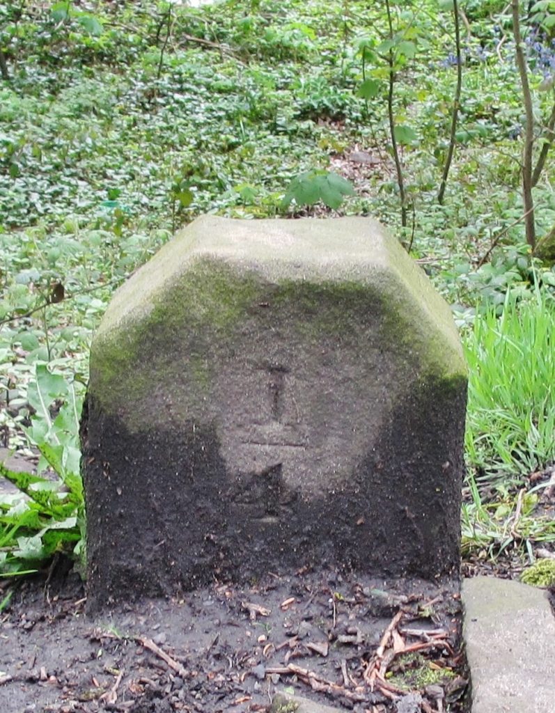
Railway company stone markers – As the canal boom was relatively short-lived due to the introduction of the railways, a number of canal companies ended up in financial difficulties and were sold to railway companies. These often continued to use the canals, particularly for bulky materials, into the 20th century. A number exist along the Kirklees Cut a couple of miles east of Brighouse. The initials stand for Lancashire & Yorkshire Railway. The stones probably marked the extent of land ownership beyond the towpath.

Towpath bridges – Horses were the only source of power until the mid-19th Century (and continued to be used well into the 20th). Where the towpath changed sides of the navigation (usually where canal and river met), a way had to be found to allow the horse to continue pulling the vessel without unhitching. This was achieved by the ‘turnover bridge’ which used to exist at Mirfield, Cooper Bridge, Brighouse and Elland. All these are long gone but a good example can still be found at Battyeford where the canal reaches the river.
Lock-keepers cottages – Many locks had cottages for the lock-keeper and fortunately a number still survive. A good example can be found at Salterhebble – pictured at top.
An edited version of an article by David Garside in the Milestone Society Newsletter, Jul 2013, no 25, pp 26-27.
Milestones and other features on the Calder & Hebble Navigation Read More »

In mediæval times, bridge chapels served an important function as wayside chapels for pilgrims. Mediæval bridges were often the only way of leaving a town or city to venture into the countryside across the farthest bank and, as many towns were established across rivers, they must have been plentiful. But did they also serve another purpose?
The authors of a guidebook to the bridge chapel at Derby* clearly think so. They state ‘Bridge chapels served a number of purposes. They were places where travellers leaving the relative safety of a town would call to pray and receive a blessing before setting out on a possibly dangerous journey through the countryside beyond. Others, about to enter a town, might have paused to offer thanks for a safe arrival. Tolls, for the upkeep of the associated bridges, would have been levied on incoming goods and animals.’ They go on to state ‘It was customary in those days for the daily upkeep of the chapel to be the responsibility of a so-called hermit, appointed by the bishop. The hermit, who lived in the chapel, was also responsible for the collection of tolls.’
So there we have it. As tolls were extracted for the upkeep of the bridge, perhaps the bridge itself belonged to the church? But why are there so few bridge chapels left in England? With the coming of the Reformation, such chapels fell out of favour and by 1547 all had been closed. The subsequent arrival of industrialization and the turnpike era rendered mediæval bridges too narrow for traffic so many chapels, now redundant, would have been demolished.
It is fortunate that a few bridge chapels still exist, and two of them are in Yorkshire, at Wakefield and Rotherham.

Wakefield was an important town in mediæval times. The lovely little bridge chapel built around 1350 sits on the old bridge over the River Calder. It is the best bridge chapel we have despite its west front having been faithfully rebuilt by George Gilbert Scott in 1847. Another reference to toll collecting comes from 1342 when toll rights were granted to the bridge, eight years before the chapel was erected and 15 years before the chapel licence was granted.
The bridge chapel at Rotherham, although similar in style to the one at Wakefield, is well over a hundred years younger. It was heavily restored in 1924. The bridge itself, although mediæval, was widened in the 18th century and narrowed back to its original width in the 20th. It is a miracle that the chapel survived the original widening. Both Wakefield and Rotherham chapels are rectangular with typical ecclesiastical features.
Other bridge chapels are at Cromford (Derbyshire), Derby, St Ives (Cambridgeshire – pictured at top), Bradford-on-Avon (Wiltshire) and Rochester (Kent). Spare a thought for those early pilgrims, having to pay tolls to fulfil their religious desires.
* Robert Innes-Smith: The Chapel of St. Mary on the Bridge, Derby (Derbyshire Countryside, 1987)
A longer version of this article by John Higgins appeared in Milestone Society Newsletter, August 2016, no 31, pp 21-22.
RWH / August 2020
Bridge chapels: our first toll-houses? Read More »

How about standing on a corner and seeing five milestones without moving? You can in Yorkshire. Visit Pool Bank, north of Leeds, at the junction of the A660 ‘new’ Leeds to Otley road with the A658 Bradford to Harrogate road and the Dudley Hill to Killinghall turnpike in Bramhope Parish.
In Bramhope and Adel parishes there are at least ten ‘tombstones’ with numerous places listed including Adel Brickyard and several churches and bridges. The distances are given in miles and furlongs. On one of these stones, a few yards north west of the traffic lights, Otley, Burley, Ilkley, Addingham and Bramhope churches are inscribed, together with Adel School, Woodhouse Moor and Leeds Bridge. On the other side of the road about 100 yards away is a triangular cast iron post, one of five on the A660, showing Leeds 8, Otley 2½ and London 194¼.
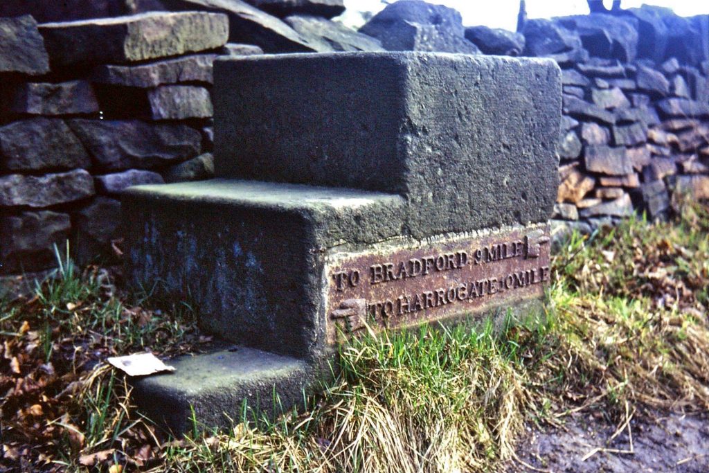
Now look up the A658. Immediately on the left is a ‘Bramhope’ stone with nine places inscribed although some of the distances are erased or eroded. Then there is a mounting block type complete with metal plate and hands pointing To Bradford 9, To Harrogate 10 – pictured below . There are four more of these left between here and Bradford but none with plates.
A little further up is the third and youngest stone belonging to the Dudley Hill, Killinghall and Harrogate Turnpike of 1758. Dudley Hill is to the south east of Bradford and Killinghall is to the north of Harrogate. Riding from Dudley Hill you are soon on Killinghall Road although the end is 23 miles away. There are none of these 19th century stones with protruding metal attachments nearer to Bradford but there are ten complete and one broken one on the B6161 to Killinghall with one on the B6162 Harrogate branch.
Christine Minto
Reprinted from Milestone Society Newsletter, July 2004, no 7
A unique place: five milestones without moving Read More »


Standing on the western side of the Pennine watershed, the area of Saddleworth belonged (and belongs)historically to the West Riding of Yorkshire. Though part of the ancient parish of Rochdale, and transferred to Oldham in Greater Manchester for administrative purposes in 1974, it is still defiantly Yorkshire in spirit.
With a confusing pattern of subdivisions and boundaries, it is hardly surprising that there is a wealth of boundary stones to be found in the district. They are of two types: firstly there are markers to denote where the township met surrounding townships, and secondly there are internal boundary markers, for it was never, until 1937, one unified administrative area.
Following the Norman Conquest it became a part of the Honour of Pontefract, and was divided into four quarters or ‘Meres’ (the word simply means ‘boundary’): Friarmere, Shawmere, Lordsmere and Quickmere. Confusingly the whole district was also once knownsimply as ‘Quick’. The Meres were further subdivided, into Divisions. To complicate matters further, in the 19th century with reforms of local government and the creation of Urban and Rural Sanitary Districts (later Urban and Rural District Councils), Saddleworth appears to have had three units: Springhead Urban District (originally established in 1864 and called Quickmere Middle, though it also included the Upper Division); Uppermill Urban (Sanitary) District (formed in 1868, a small area covering just Uppermill, the largest settlement in the district – on the western edge of Lordsmere); and Saddleworth Rural (Sanitary) District (formed in 1876, and presumably covering the remainder of the district). In 1900 Uppermill and the Rural District were combined to form Saddleworth Urban District, and in 1937 Springhead UD was absorbed into it.
The Meres had by then ceased to have any official role, although the names survive on some of the milestones erected by the County Council in the 1890s. The present-day settlements grew long after the mere boundaries were fixed, but the following lists indicate what was where.
Friarmere belonged to Roche Abbey – hence the name; it had two poetically named divisions:
Dark Side, the most northerly part of the district, including Denshaw and down as far as the outskirts of Delph;
Light Side, including Castleshaw.
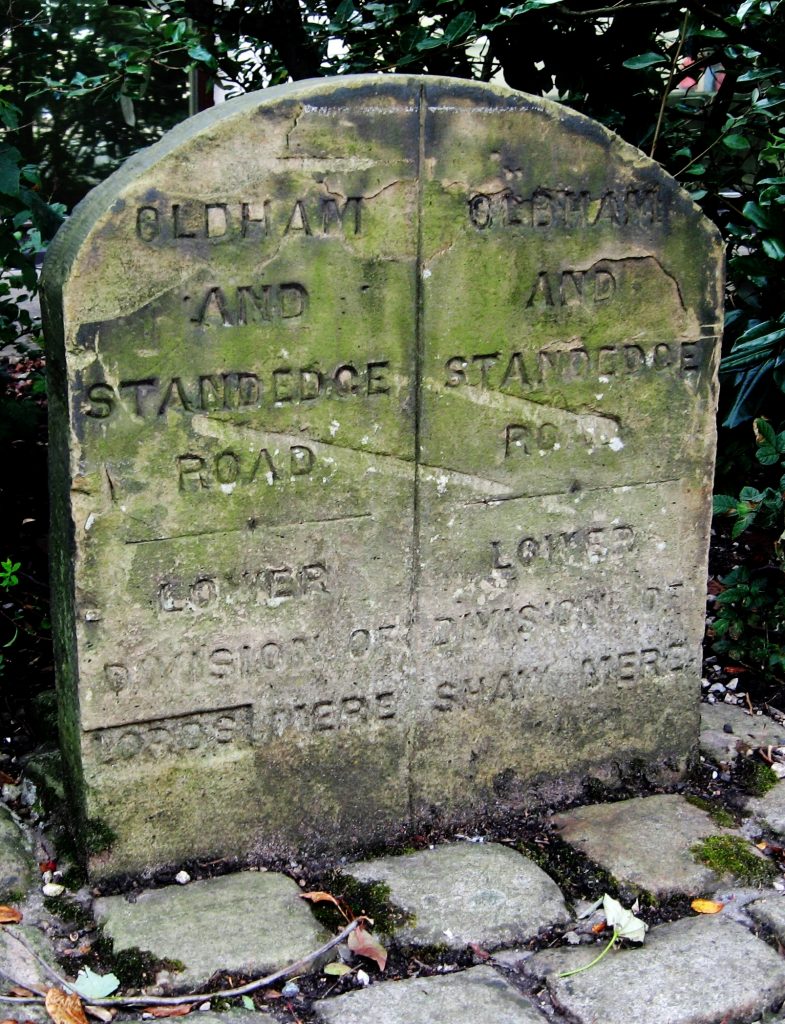
Lordsmere, the eastern, and by far the largest, part of the district, including Diggle, Delph, Dobcross, Uppermill, part of Greenfield, and Saddleworth Moor. This was directly controlled by the Lord of the Manor. Boundary stones indicate it had three divisions (Upper, Middle and Lower), though these are not shown on the first edition Ordnance Survey maps.
Quickmere, in the south-west, had three Divisions; from north to south these were:
Upper, a small very sparsely populated area;
Middle, including Scouthead, Austerlands, Springhead, Grotton, Lydgate and Grasscroft;
Lower, the area also known as Quick; the Lower Division was transferred to the newly created Borough of Mossley in 1885.
Shawmere, a small district based on Shaw Hall, between Quickmere and Lordsmere, had two divisions:

Upper, a sparsely populated area between Scouthead and Dobcross;
Lower, including Shaw Hall and part of Greenfield.
Saddleworth had borders with 11 other townships. They are listed here, clockwise from the north, with details of some of the boundary stones to be found:
in Yorkshire:
Marsden-in-Huddersfield: no 1, on the A640 Huddersfield – New Hey road; presumably erected by the Marsden township as it says only MH on one side with no evidence of an S on the other. A series of mounds then follows the boundary south over the moors, past the Standedge crossing, and through …

Marsden-in-Almondbury, with more mounds;
Austonley: a short section on the highest part of the A635 (the Greenfield – Shepley Lane Head road) as it crosses the notorious Saddleworth Moor: no 2.
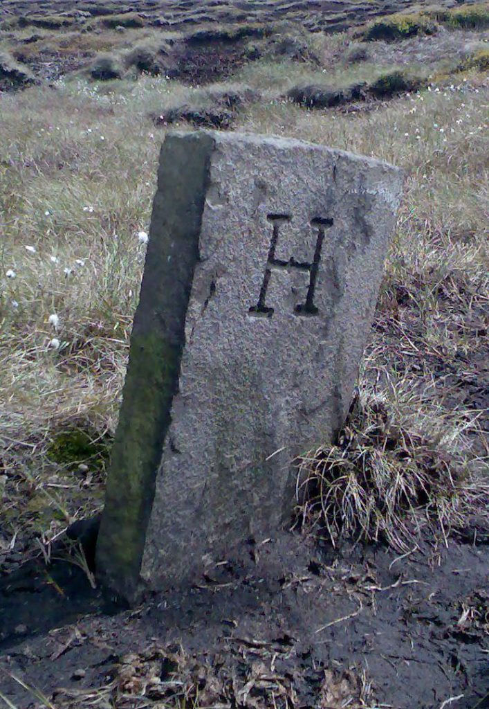
Upperthong: no 3 (photo by David Garside) is half-a-mile south of no 2 on Dean Head Moss, where the boundary line takes a 90o turn. It has S on one side and H on the other: the H is for Holmfirth, so this must have been erected after 1894 when Upperthong was merged with other townships into the new Holmfirth Urban District.
in Cheshire (though transferred to Derbyshire in 1974):
Woodhead and Crowden: two hamlets in Tintwistle township; mounds
Tintwistle: more mounds.
in Lancashire:
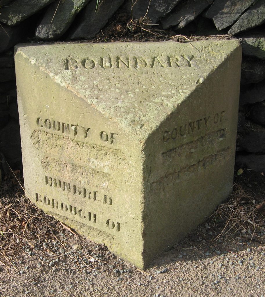
Mossley (part of which was once actually in Cheshire): in 1885 the newly-created Mossley Borough erected boundary stones on all the roads leading into the Borough, all of which were defaced in World War Two to confuse any invaders. At least seven of these survive, including five on the roads into Saddleworth – the A6050, A670, A635, B6175 and the unclassified Under Road. They were most informative, even providing the name of the Hundred (Salford) in which Mossley was situated – but ignoring the detail on the West Riding side. The one pictured (no 4) is on the A670.
Hartshead and Alt: two small townships: no boundary stones traced;
Lees, a narrow township on the A 669, but with a small piece just crossing over the A62: there are two stones on the A62 at Austerlands, erected by the Springhead UD. Going towards Oldham the road enters Lancashire – the stone here mentions Lancashire, but doesn’t bother to mention Lees, which is why we assume it was Springhead who put it up – but after a couple hundred yards re-enters Yorkshire for a very short distance (no 5, which does mention Lees).
Crompton (with its main town Shaw): at Grains Bar on the A672 a stone marks the boundary between Crompton and Friarmere (no 6). The county names, Lancashire and Yorkshire, are on the left- and right-hand sides.
Milnrow: where the A640 New Hey Road (whose other end went through Marsden) leaves Saddleworth (Friarmere again) is a final boundary stone (no 7); this one also names the counties on the sides. The Milnrow Local Board was created only in 1870, before which it was part of an ancient township called Butterworth
The similarity in style of nos 6 and 7 suggests that they were erected by the Friarmere township, presumably sometime between 1870 and 1894 when Local Boards became Urban District Councils.
Then there are several stones marking the boundaries between the Meres, including their Divisions. These are two examples:
No 8: the boundary between the Middle Division of Lordsmere and the Upper Division of Shawmere; this is on the A62 at Delph, opposite the Old Bell Inn.
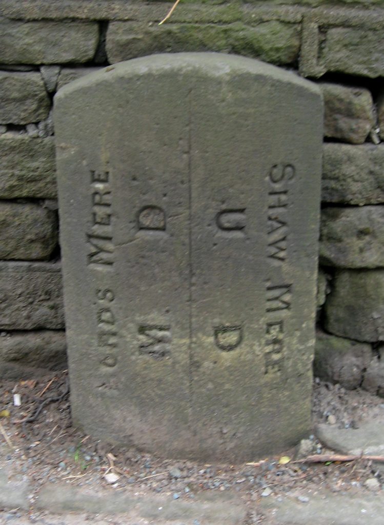
No 9: the boundary between the Lower Division of Lordsmere and the Lower Division of Shawmere: this is on the A689 at Greenfield. Interestingly, the carver was obviously confused here as well, as ‘Lords’ had to be re-carved over something else.

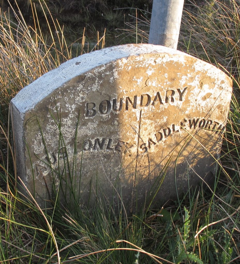
And finally there are examples of the boundaries of the later local authorities. As well as the Springhead UD stones noted above (no 5), there are two stones marking Springhead’s boundary with Saddleworth UD, so dateable to post-1900 when the latter was created. No 10 is on the A669 beyond Grasscroft, the last settlement in Quickmere.
Meanwhile at the northern and southern ends of Uppermill on the A672 are two stones marked simply A ULB BOUNDARY (to the south) and B ULB BOUNDARY (to the north) – put up by the Uppermill Local Board (no 11).
Sources: An article by David Garside in the Milestone Society Newsletter, Jan 2014, no 26, pp 26-27; articles by Mike Buckley on the four Meres in Saddleworth White Rose Society Newsletters, 2009-2010, nos 45 and 46; www.visionofbritain.org.uk; the catalogues of the National Archives at www.nationalarchives.gov.uk; old Ordnance Survey maps at https://maps.nls.uk.
RWH / August 2020
Saddleworth boundary stones Read More »