7 January 2022

B&Bs? Or should we call them Steads?

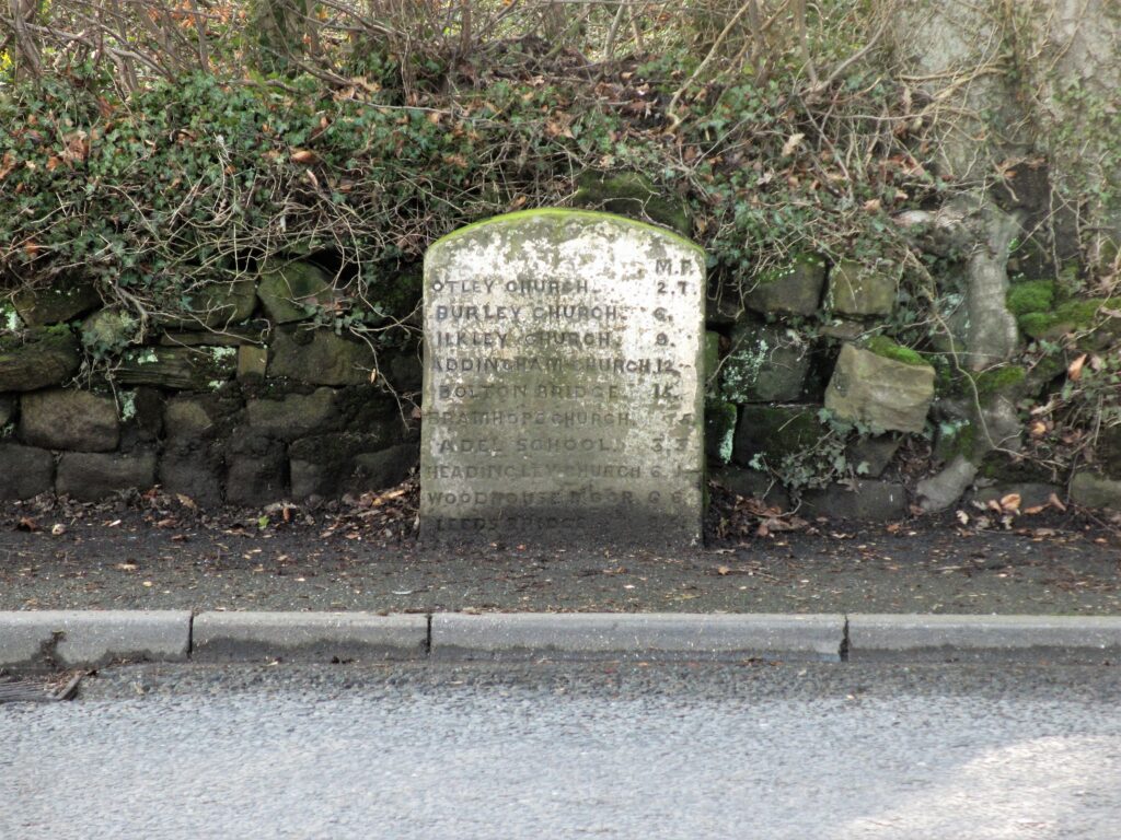
On nearly 70 roads all over the former West Riding of Yorkshire nearly 400 milestones can be found in a standard style.  Attached to a solid rectangular stone column a metal plate shows destinations and distances.  At the top are the names of the road and the township in which the stone is located.  And between these can usually be found the words Brayshaw & Booth / Makers / Liversedge.  For this reason we tend to refer to these milestones as “Brayshaw & Booths”.

Perhaps, however, we should instead call them Steads.

While Henry Brayshaw and John Booth did cast most of them at their (long gone) foundry in Millbridge, it was Gill Stead and his son Frank, stonemasons in Mirfield, who in 1893 tendered for and won the contract from the newly-formed West Riding County Council for “supplying and fixing 615 milestones upon the main roads in the said West Riding”.  A great-grandson of Gill Stead, Brian Whittaker from Stoke-on-Trent, found a copy of the original contract, which is now available at the West Yorkshire Archive Service in Wakefield.

Gill (1836-1904) was born in Mirfield, the illegitimate son (according to the baptism record) of Ann Stead.  The 1841 census records him living with Joseph Stead, a clothier and presumably a relation, and his wife Mary, at Battyeford.  His mother Ann, meanwhile, is living at Bank House, owned by Benjamin Wilson, described as a landed proprietor in a later census.  Bank House, off what is now Francis Street, was then in extensive landscaped gardens.

Ann continued to live at Bank House, as a servant, until 1857 when she married.  She became the third wife of John Gill, described as a labourer on his marriage certificate and a dairyman in the 1861 census.  It would not be unreasonable to conclude that John Gill was Gill’s father.  Did Ann name her son Gill because she loved his father, or to shame him?

Gill and Mary Stead

Gill does not appear in the 1851 census: apprenticed to become a stone-mason, he was perhaps elsewhere and got left off.  In 1861, now a stone-mason, he is living at Bank House.  Also living there was Mary Taylor, the cook; she and Gill married in 1863.  Later censuses record them with an ever-growing family at various addresses in Mirfield – finally, in 1891 and 1901, on Crossley Lane. 

In 1891 his eldest surviving son, Frank (23), the business partner named in the contract, was also living there.  Ten years later Frank is married with two daughters, but in 1911, with his father dead, he would appear no longer to own the business, describing himself as an employee.  He died in 1919, aged just 51.

Another son of Gill’s, Joseph, who was born in 1871, was also a stone-mason and living with his parents in 1891.  The last census entry for him, in 1911, records him at his widowed mother’s house on Crossley Lane, a stone-mason, a “worker” and married, but other information is frustratingly absent.  His wife, however, appears to be living in Ravensthorpe and taking in boarders.

According to the milestone contract the Steads had to ‘find and provide and be at the expense of all materials, tools, labour, carriage and others matters mentioned or referred to’.  This involved:

  • obtaining and paying for the 615 stones, mainly but not necessarily exclusively from a quarry in Horsforth;
  • commissioning and paying Brayshaw & Booth (or sometimes other ironfounders) to cast and paint the iron plates – each one different, of course, and sometimes with 150 or more characters per stone;
  • transporting them to all parts of the county – from Sedbergh in the north-west (70 miles) to the villages south-east of Rotherham (nearly 40 miles) as well as over the hills to Saddleworth; they may have used horse and cart, or the then more extensive railway network;
  • locating where they were to go (a road measurer had been employed to mark these places with wooden stakes), bolting the plates on, and fixing them two feet into the ground (the stones were six feet long);
  • and finally when in situ giving them another coat of paint.

And all was to be done within twelve calendar months of the date of the contract.

The blue “Stead” at Mirfield

For this mammoth undertaking they were paid £1,140, or £1-18-0d (£1.90) per stone.  And it was all done between August 1893 and August 1894 as stipulated.

One interesting item in the contract states that the milestones were to be painted blue, with white letters, though almost all the surviving milestones are white, with black letters.  Some do in fact show traces of blue paint underneath, but it is not known when it was decided to change the colours.

One, however, was repainted blue in 2012 to celebrate the Queen’s 60th Jubilee, but with gold letters.  Appropriately in view of the local link this is in Mirfield, on the A62 just west of Stocks Bank Road.  If you’ve passed by and not noticed it, that was probably why they re-painted them white.  

Sources: article by Christine Minto in the Saddleworth Historical Society Bulletin, 2015, vol 45 (1), pp 1-17; census records

RWH / Jan 2022

B&Bs? Or should we call them Steads? Read More »

Guide-stones between Otley and Leeds

As well as the turnpike milestones on the road to Otley, another set of stones on the same road is extremely interesting and unique in the county.  There is no word to accurately call them by.  They are often referred to as mileposts as they show distances, in miles and furlongs.  But they occur at road junctions rather than at one-mile intervals.  Here we call them guide-stones, as they list many nearby places.  But although places are listed in a logical sequence they do not appear to show actual directions. 

The places named are often towns and villages, but more frequently they are individual buildings, especially churches – around ten of these – and other landmarks. The picture below illustrates this: there are halls, roads, a cross, a station and a church. And also a peculiar Germanic spelling of Otley Chevin.

Some towns beyond the area are mentioned, once: Bradford, Ilkley, Skipton.  Otley is named once, and its church on four stones.  Leeds itself is not named, but Leeds Bridge, the ultimate end of the turnpike, is listed on eight stones.  Other villages named, both on the line of the road and off it, include Burley, Chapeltown, Meanwood, Old Bramhope  and Tinshill, again usually just once.

More common than the actual villages, however, are their churches, of which 15 are named, from Addingham to Yeadon.  Other landmarks include Otley Chevin (spelt as a rather Germanic Schevin), Pool Bank, Woodhouse Moor; also Bolton Bridge (near Bolton Abbey) and other bridges at Horsforth, Kirkstall and Leeds.  Some houses of local bigwigs are named, though the average traveller was probably not heading for them: Arthington Hall, Cookridge Hall and Kirskill Hall.  The last-named is now known as Creskeld Hall, and has featured as a location in Emmerdale and other TV programmes.  Adel School is listed, sometimes in preference to its notable Norman Church.

Arthington Station is named on several stones, as is Carr Bridge Station.  These stations, part of the original Leeds and Thirsk Railway, now the Harrogate Line, opened in 1849.  The name Carr Bridge Station appears to have been very short-lived: the Ordnance Survey map published in 1851 refers to it as Horsforth Station, and the bridge (over Moseley Beck) is called Horsforth Bridge.  An official accident report of 1849 refers to the station as “Carr Bridge or Horsforth Station” and the accompanying plan names the bridge as Carr Bridge.  The name survives in a couple of nearby, much more recent streets, Carr Bridge Avenue and Carr Bridge View.  [Not to be confused with Carrbridge in Perthshire, whose station did not open until 1892.]

Another transport-related destination was Carlton Bar: the old turnpike went through Carlton township, and the bar and toll-house were at the crossroads with the Dudley Hill – Killinghall road.

The stones are large, with anything up to ten places named, such as one opposite the (currently closed) Dyneley Arms – pictured.  This has the destinations listed on just the front, but others have places listed on two sides  One of these, for example, can be found near the church in Bramhope: it has four on the front, facing the road, and four more on the right-hand side facing up Church Hill.  There are also places where two stones can be found on opposite sides of the road, facing each other; an example is in Bramhope at the crossroads with Breary Lane.

Thus the second stone at the Breary lane crossroads lists, all south and west down Breary Lane:

  • Bramhope Cross
  • Old Bramhope + (ie Cross)
  • Otley Schevin
  • Carlton Bar
  • Guiseley Church

and all north up Breary Lane:

  • Kirkskill Hall
  • Arthington Hall
  • Castley Ford Lane
  • Arthington Station

The peculiar thing about all these stones is that there appears to be no indication of the direction the traveller needs to take to reach the place named.  There is, however, a certain logic to it: places are listed in roughly increasing distance, first towards Otley, and then towards Leeds.  Where there is a pair of stones this is at a crossroads; one stone will list destinations on the main road, and the other destinations on the minor road.  Thus the second stone at the Breary lane crossroads lists:

Places in Adel are named on eight stones.  The school is on four; this is presumably the small building marked ‘Village School’ on the Ordnance Survey map of 1851, and actually on the turnpike road.  A brick yard is on two: White’s 1853 directory of Leeds lists a Samuel Whitaker, brick and tile maker, and the OS map shows a tile yard in an area now occupied by housing.  The beautiful Norman church is mentioned on only one, as is the bridge, about one third of as mile beyond the church over the relatively insignificant Adel Beck.

Since the stones are sited in all the townships or parishes through which the road passed (including Headingley, Adel and Bramhope) they are unlikely to have been put up by the townships, and we presume that they were the brainchild of the Turnpike Trust.  Sources (Wikipedia and others) indicate that the mileposts were erected in 1850, but without specifying which type is meant.  This is probably true for the so-called “tombstone” guide-stones since they cannot have been earlier than 1849 (the date of the stations), and the guide-stones do not appear on the first OS maps (based on surveys begun in 1847).  The turnpike milestones are shown, however, and were probably in position when the road opened in 1842. 

RWH / Jan 2022, rev Sept 2024

Guide-stones between Otley and Leeds Read More »