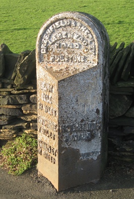
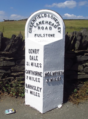
Northern Spring Meetings at Hebden, 2004-2019
As well as a variety of Yorkshire meetings in various locations the Society held an annual Yorkshire (later expanded to Northern) Spring Meeting, from 2004, in the village hall at Hebden near Grassington (not to be confused with Hebden Bridge). The meetings and speakers were organised by Jan Scrine, who (almost) invariably chose a bright sunny day when the Dales were looking their best. There were 23 people at the first meeting, and 24 at the last, though attendances had reached over 40 some years. Details of these meetings follow, excluding references to cakes, sheep, lambs and the weather.
2004
The first Hebden meeting, with 23 people in attendance.
Brian Ellis and Lionel Scott gave talks on milestones and roads (what else!)
It was agreed to have a Yorkshire Newsletter.
2005
Janet Niepokojczycka gave a superbly-illustrated and fascinating talk on “Packhorse days and packhorse ways”, describing her trips for charity with a horse, pack-saddle and panniers over many muscle-aching miles.
Christine and Frank Minto covered a lot of ground with their travels and recent developments including North Yorkshire restoration efforts.
June Scott described the “Perambulation: beating the bounds of Harrogate”.
Jan Scrine gave a national update and also described the Barnsley to Grange Moor project.
2006
Alan and Ruth Thompson gave a “virtual tour” of the picturesque island of Arran and its milestones.
Martin Imeson showed a miscellany of milestones from around the UK.
June Scott entertained with “dark doings” at toll-gates in historical fiction.
2007
The Thompsons returned to Scotland with a “Hebridean Hopscotch”.
Chris Marcus told us all about Saddleworth, a “milestoner’s paradise”.
June Scott introduced us to the “obnoxious” William Cobbett, of “Rural rides” (1830): “Those who travel on turnpike roads know nothing of England”.
Colin Smith from Cumbria enthralled with their HLF-funded restoration project.
2008
Chris Marcus described his research on fingerposts, with reference to Saddleworth.
Brian Ellis shared some anecdotes about his restorations.
Jan Scrine looked at a highway surveyor’s costs for repairing roads in Cornwall in the 1770s.
Richard Heywood gave a comprehensive overview on boundary markers.
Christine Minto updated the meeting on the so-called Brayshaw and Booth milestones of the West Riding: a copy of the original contract has come to light.
2009
Local historian Maurice Taylor introduced us to the Ancient Right of Sanctuary, including boundary stones around Ripon.
Christine Minto took us on a tour of Scotland, with excellent photography of landscapes as well as mileposts.
June Scott cast light on the life of the rakish Blind Jack of Knaresborough, from the research by Dr Arnold Kellett. Dr Kellett came along and read a poetic tribute, too.
2010
Terry Witham gave us a light hearted introduction with her research on the history of the village and its roads and tracks.
Our guest speaker Dr Geoffrey Boswell amused and enlightened us with his anecdotes about Causeways, Guide Posts and Crosses around Todmorden.
Richard Heywood introduced us to his discoveries on Chapelry boundary stones.
Christine Minto took us on a tour of Cumbria and Scotland, well illustrating the vast variety of waymakers that exist.
Jeremy and Dave (the “Dynamic Duo”) updated the meeting with news of their restoration projects.
2011
Mike Lea, with Kate, managed to convince his audience that fingerposts are actually worth studying, by showing different Cumbrian styles and amusing anecdotes, supplemented with practical expertise by Duncan Armstrong.
Janet Niepokojczycka gave her latest talk “The Packhorse in Art and Literature”, with colourful illustrations ranging from the Luttrell Psalter to Christmas cards, of beasts of burden and their accoutrements.
June Scott had some vivid coaching tales including insights from ‘Pickwick Papers’.
Jeremy Howat explained how the Ryedale project had been such a successful collaboration. the day, Christine Minto set a quiz based on the recent OTG and Newsletter, which caused much merriment as well as blank looks – won by Richard Heywood with just 12 out of a possible 20 marks!
2012
Curiously there was little mention of actual milestones.
Christopher Evans from Scarborough, described his findings on “Trods – paved ways in north-east Yorkshire”, as used by panniermen, fish merchants and smugglers. Click here for full details.
David Garside gave a profusely illustrated talk, with the provocative title “Boundary stones – more interesting than milestones?” Those of us who share that view were treated to a wide variety, plain and fancy: county, monastic, manorial, chapelry, industrial and parish – as were those who don’t.
Jan Scrine showed us the Society’s latest publicity ventures, being produced with the cooperation of Barnsley poet Ian McMillan. Already out on YouTube is The Rabbit and the Milestone, showing how easy it is for any rabbit to find our milestones on Google Earth. Watch it here:
“Cross at the cross-roads, 230 miles to Clovelly and a real puzzle” by Dr Lionel Scott, who showed us some intriguing waymarkers at junctions, ending with a plea for anyone to identify an obliterated destination “67 Miles” on a pre-turnpike milestone from the Great North Road at Robin Hood’s Well, seven miles north of Doncaster. Rescued when the A1 was widened back in the 1960s this now resides in a garden in nearby Brodsworth. [Personally, I think it’s lost the figure 1 and is 167 miles to London – Ed.].
2013
Michelle Atkinson described a project to produce a series of walk leaflets in Kirkburton (in Kirklees, West Yorkshire). Each of the ten walks is based on one of the villages in the parish area and a local character, and each features a stone guide-stoop carved by local sculptor Dave Bradbury, fashioned in the style of the notable Farnley Moor stoop, and depicting a feature of the village. These can also be found at http://kirkburtonparishwalks.co.uk
Michelle managed the project, and she described the entire process from to conception to fruition – a most useful presentation for anyone planning anything similar. She discussed everything from how to manage volunteers to sources of finance (starting with www.fundingcentral.org.uk); who knew, for example, that landfill companies (such as SITA in Kirklees) have funds for relevant projects in their area? See http://www.entrust.org.uk/home/lcf for further details. Some of us would also have liked to have seen some more of the guide-stoops.
Dave Bradbury then enthralled us with his description, with photographs of every stage, of the processes involved in another of his works: the Milestone Society’s Diamond Jubilee project replica Roman milestone at Wall, Staffordshire, by the site of the Roman town of Letocetum. See his website at http://bydavebradbury.co.uk.
Jan Scrine then went on to tell us about some of her many plans to interest young people and other groups, from geocachers to trainee bricklayers and home educators, in milestones – details of her activities can be found on the new “Beyond Graffiti” section of the Yorkshire website. After which we all(?) joined in the chorus of The Jagger’s Refrain.
Gordon Hallas showed us many fascinating old photographs of Holme (at the top of the Holme Valley) on his epidiascope, a historic magic lantern.
Jeremy Howat did “The ones that got away – or did they?”, telling the stories of some of our more elusive milestones.
2014
A “Milestone Miscellany” presented by the double-act of Dorothy Burrows and her husband. We were shown a selection of slides taken over many years showing interesting and unusual waymarkers from Yorkshire and beyond.
Shirley Addy, founder of the Village Sign Society (www.villagesignsociety.org.uk) gave a most interesting presentation on village signs. We think of these as an East Anglian phenomenon (Norfolk has the most) but there are over 200 in Yorkshire and over 3,000 across the country as a whole.
Jan Scrine gave us an update and short film on the Beyond Graffiti project. See www.youtube.com/watch?v=0JwREVwVmRU.
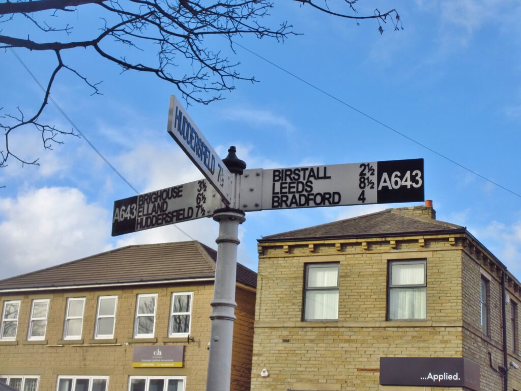
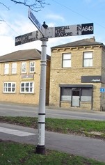
Richard Heywood then gave a whistle-stop tour of street-names and their meanings, with particular reference to those connected to road and transport history.
David Garside presented moorland crosses, with around 70 examples of all types (Saxon, monastic, estate, boundary, waymarker, etc) from the well-known ones on the North York Moors to lesser-known ones around Penistone and Thurlstone and farther-flung crosses on Dartmoor.
2015
The double-act of Brian and Dorothy Burrows gave us another entertaining selection of slides from around the world: not just milestones, but waymakers of all kinds, as well as amusing signs (eg “Toilets. Maximum stay 2 hours”).
Jeremy Howat told us about the milestones on the A19 (York-Easingwold-Thirsk-Northallerton), and reporting on his research into their possible ironfounders. Click here for full details. Jeremy highlighted the milestone in Thirsk showing on one face a sheep and lamb, and on the other a figure thought to be a drover.
On that subject Mike Lea showed extracts from a Border TV film of 1988, “The Drove”, in which their intrepid reporter, fellow masochists and a dog recreated a journey made regularly in the 18th century, driving a herd of cattle from Galloway via Malham (a hub of the trade, controlled by the local Birtwhistle family) and Norfolk (St Faith’s, near the airport, and for seven centuries host to one of the country’s largest cattle fairs) to London. Drove roads once covered the country (albeit without milestones), but the drovers’ lives were made increasingly difficult with the growth of turnpikes (with their attendant costs) and the enclosure movement, and the trade was dealt a final fatal blow by the railways.
David Garside introduced a completely new (to us) type of boundary marker, the turbary stone. These are found on moorland areas where peat was dug, turbary being land where turf or peat may be dug for fuel, or as a legal term the right to dig for it. Click here for all the details. He also revealed that Garside Hey, part of Marsden Moor, is named after his ancestors, who had such rights.
Jan Scrine updated us on her ongoing Beyond Graffiti project, and entertained us with the triumph, trials and tribulations of the award-winning Crossing the Pennines scheme – grand opening on July 4th (barring acts of God or Kirklees).
2016
This time we were entertained (again) by Dorothy and Brian Burrows, informed by Margaret Hill (eg about stiles, of which there are four kinds: step-through, climbing, combination and mechanical), and exhausted by David Garside (illustrating five ancient routes across the Pennines – he’s walked them all, and more).
Bill Froggatt was our guest speaker, who won the Terry Keegan Award in 2014. He now works for the Canal & River Trust on the Leeds-Liverpool Canal. Its 127 miles and 91 locks were completed in 1816 – it is thus celebrating its bi-centenary this year. He took us along the canal and its branches, illustrating mileposts and describing current restoration works. It was a valuable perspective reminding us that we are but a part of a wider network appreciating our travel heritage.
Christine Minto illustrated her own canal travels at home and abroad, with some excellent photographs.
2017
Dorothy and Brian Burrows began the proceedings with the usual cornucopia of photographs of milestones and related objects from around the world.
David Garside told us about the South Pennine Walk and Ride Festival, an annual event each September, for which he has been organising walks for a few years. David’s Blackstone Edge walk covers 10-11 miles, including Roman (allegedly), packhorse and turnpike roads, mediaeval crosses and boundary stones.
June Scott gave a talk on historical distance measures. Younger members of the audience (had there been any) would have marvelled at the peculiar units that were once everyday concepts: how much simpler (but less colourful) the metric system is. Besides miles and their fractions older milestones often feature furlongs (originally the length of a furrow in mediaeval strip fields, later standardised at 220 yards – or 660 feet as the Americans would prefer to say). A few may even show rods, poles or perches: some of us well remember these from primary school. And, of course, the chain, one tenth of a furlong, the length of a cricket pitch, and ideal for measuring distances: June had an original one to show us. The chain continued in use officially and on the railways until very recent times. Finally some measures not found on milestones, shorter ones relating to the human body, and therefore not precisely defined: the cubit, for example, the distance from the elbow to the tip of the middle finger, about 18 inches (46 cm for our younger readers).
Keith Benton took us on a milestone tour from Anglesey (Ynys Môn) – the Holyhead Road – across to Northumbria, down through Derbyshire and back up through Cheshire to Cumbria.
2018
We were entertained again by Dorothy and Brian Burrows with their international miscellany of slides.
Our guest speaker had had to drop out a couple of days beforehand with a bout of flu, but David Garside ably stepped into the breach, taking us on a scenic tour of Yorkshire’s waterways and their waymarkers.
Lionel Scott described a turnpike that failed, between Leeds and Wetherby, despite much interest from local property speculators.
Christine Minto concluded with a lightning overview of Scottish milestones.
2019
Keynote guest speaker Edgar Holroyd-Doveton filled in some of the gaps in our knowledge about turnpike roads.
David Garside showed a wide selection of interesting bridges from around the country.
New member Annie Lloyd filmed the sessions and posted the results in our facebook group afterwards.
Yorkshire member Ian Thompson (no relation to the Cornish one) introduced us to an Ordnance Survey mapping project.
Jan Scrine did a round-up of events that had happened in the past decade, our Yorkshire projects (Beyond Graffiti, Crossing the Pennines, Teach the Highwayman), the Repository and the happy outcome for Uncle Frank’s Archive.
JHS, RWH / rev April 2026

Northern Spring Meetings at Hebden, 2004-2019 Read More »


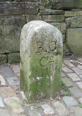

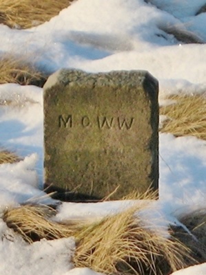 These works also needed boundary markers.
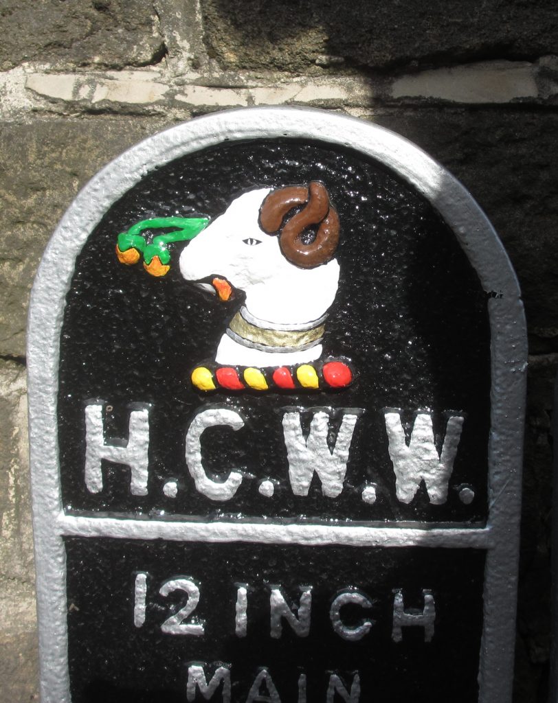 which the Holme Valley abounds), road name signs, and some plates from former water undertakings (Batley Corporation, Huddersfield Corporation and New Mill Urban District Council). The lamb that tops Huddersfield’s coat-of-arms looks especially attractive now – pictured right.